My goal is to integrate machine learning and neural networks with high-speed computing to resolve and predict complex ocean physics that were previously intractable.
In this mentoring project, Gabrielle Barnes (July 2026 - present) and Aisha Mardini (May 2025 - June 2026) aim to use GLORYS12 dataset to train the models for global bottom flow prediction.
This work is supported by NSF ACCESS Program under my lead (EES250071: Using Machine Learning and Satellite Measurement to Estimate Global Bottom Drag Dissipation”).
Nearshore Research
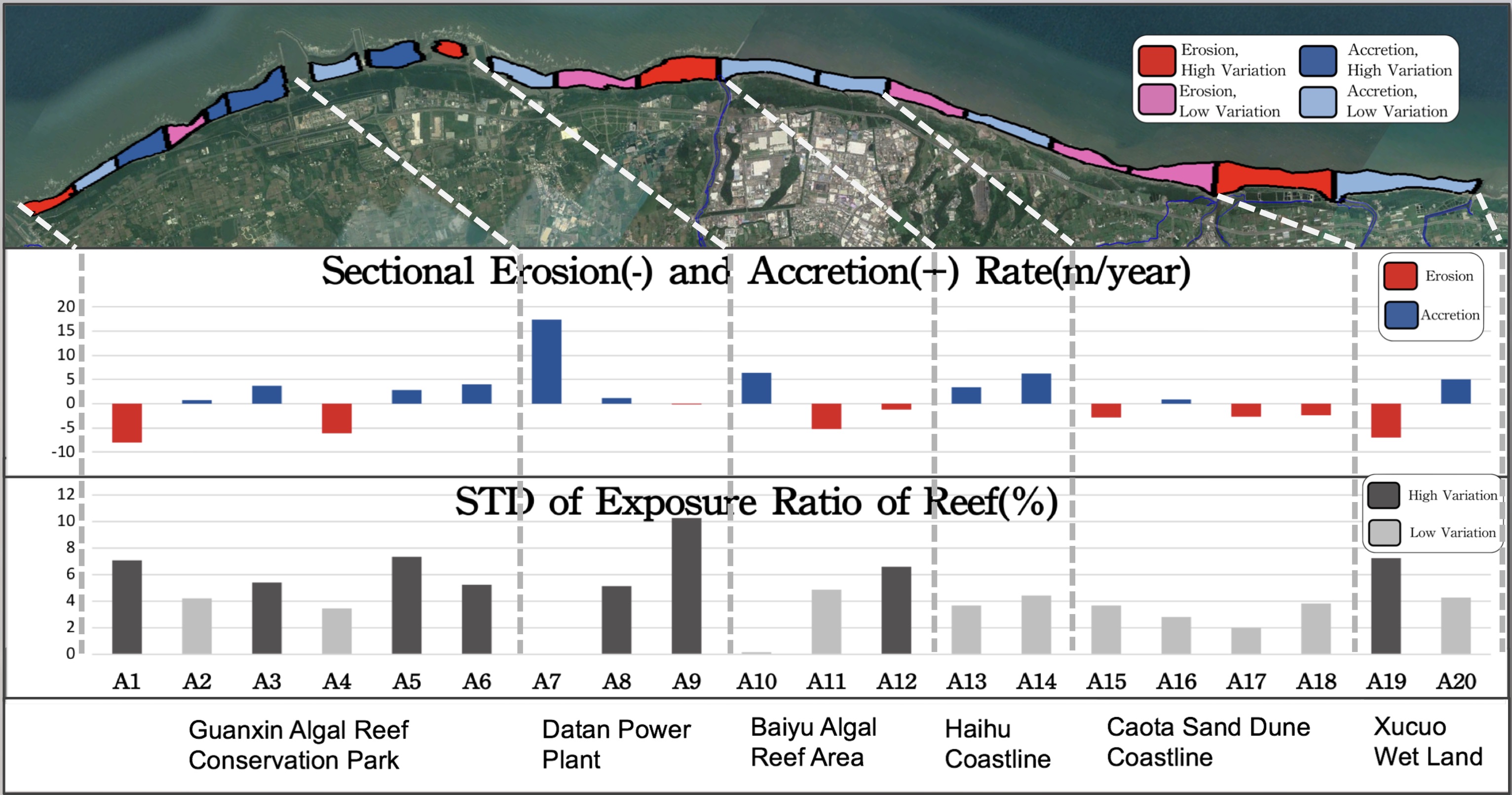 Erotion in Taoyuan coast and reef exposure. Source: AGU 2019 poster presentation
I started up a team for monitoring tidal-zone sand coverage in Taoyuan coastlie, located in Taiwan.
I developed an effective operating system for this research team which has successfully continued this project, in part due to the training practices I helped develop.
This investigation workflow enabled the local government and contractors managing a billion-dollar coastal project to monitor nearshore dynamics and assess construction-related environmental impacts.
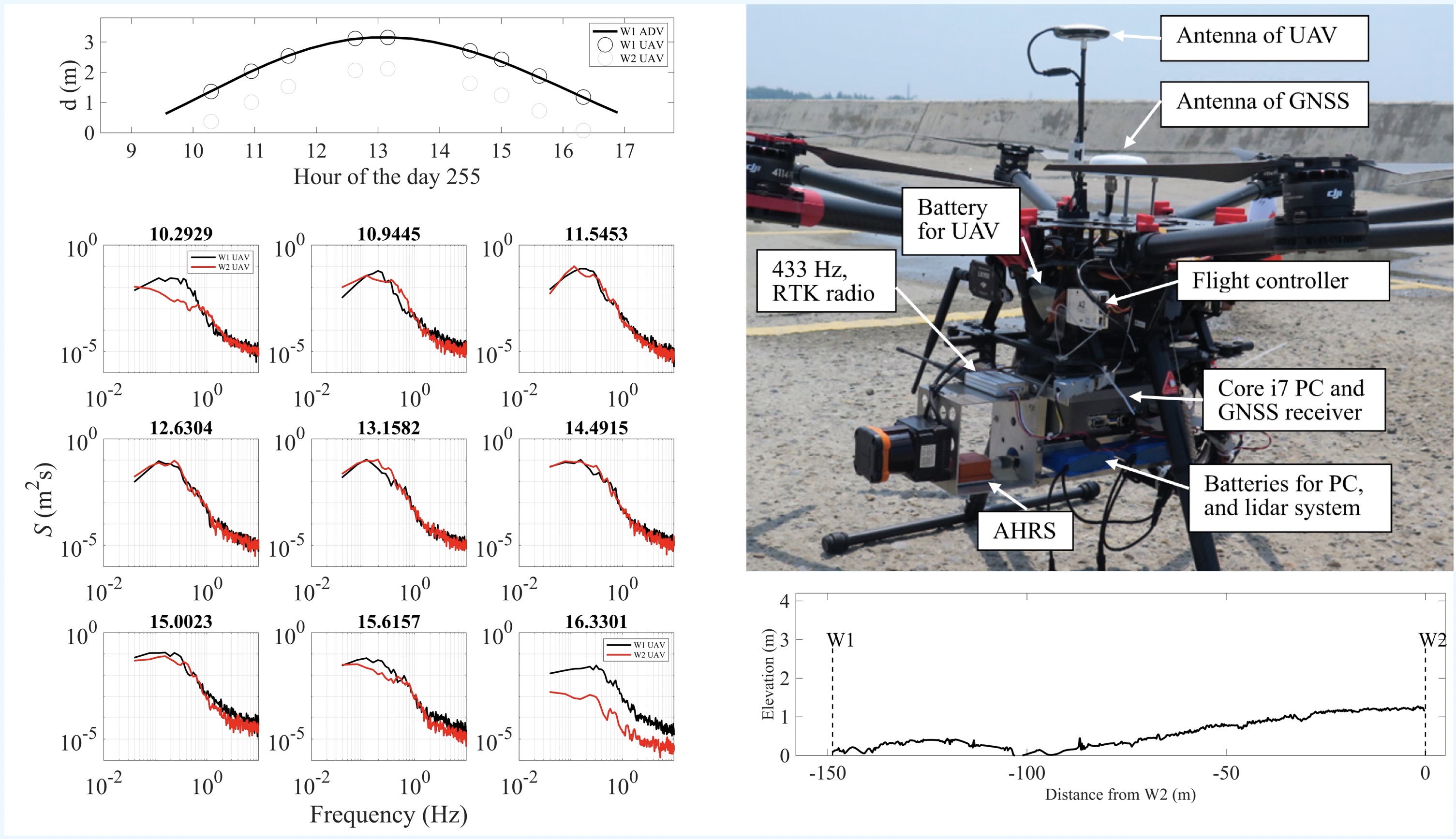 UAV LiDAR research
During my undergraduate and master research, I contributed to the UAV LiDAR system development (Hunag et al., 2018).
This autonomous system can measure waves, tides, wave energy dissipation (published in 2020 ICCE conference proceedings 10.9753/icce.v36v.waves.34, and presented in this video), and the roughness of the land surface at centimenter scale.
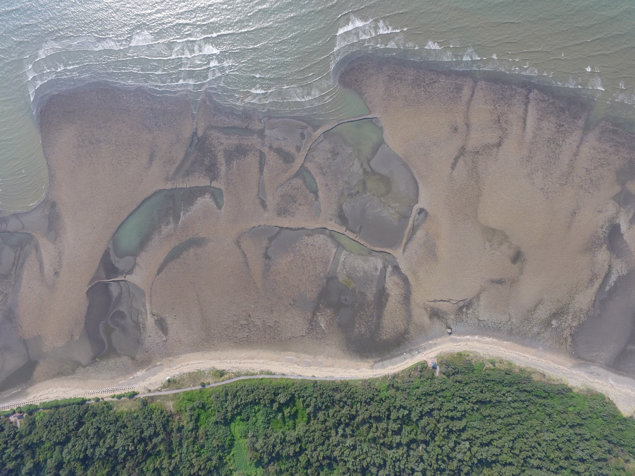 Archaeological landscape: fishing weir investigation. Source: COAST Lab
In addition to the nearshore physical dynamics research, I participated in the archaeological landscape investigation in Xinwu, Taiwan, which uses airborne imaging techniques and hydrographic measurements to understand the fishing weir sites and their relationship with tidal dynamics.
As shown in the aerial image above, stone tidal weirs are built parallel to the shoreline and aligned perpendicular to local wave and tidal propagation to maximize fishing yields.